Mobility Lab Helsinki

An

Helsinki's testbed for smart mobility.

We assist companies and researchers in testing and developing smart and digital mobility solutions on the streets of Helsinki, with real users. Our undivided attention is on smooth, safe and sustainable mobility.

Our objectives

  1. Ecosystem:
    Collaboration with different stakeholders, development and innovation community and creating new projects and pilots.
  2. Digital twin:
    Improving the usability and usefulness of data and APIs, developing tools for a mobility digital twin.
  3. Testbed:
    Enabling and supporting testing and developing new smart mobility solutions in practice, in the real urban environment.


What we offer

Click to find out about our services in the Lab!


Our projects

Want to know what we’re up to? Great!


Latest projects

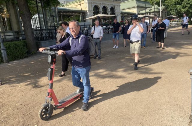
E-scooter with Drover's PathPilot

E-scooter safety tech

Companies Drover AI, Voi Technology, Vianova, VTT

Testing an AI and computer vision solution for analyzing e-scooter rider behaviour and identifying infrastructure elements.

Goal Analysing e-scooter rider behaviour

Schedule Summer-Fall 2023

Contact Juho Kostiainen, Business Helsinki

The three-month case study pilot was carried out in collaboration between Drover AI, Voi Technology, Vianova, VTT and Mobility Lab Helsinki. Drover’s PathPilot solution was installed on 25 of Voi’s e-scooters. In the first phase, it collected data about the infrastructure the e-scooters ride on. The second phase of the pilot introduced audio signals related to rider behaviour (such as alerts when riding on pedestrian streets, parking).

The case study produced a white paper analyzing the observed rider behaviour. The results were promising. For example, riding e-scooters on sidewalks was reduced during the test period. Continuation of testing with an expanded time and scope might be considered. Read more about the results.

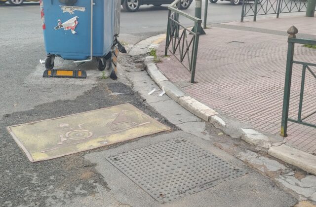
“From the images collected by the scooters, we obtained accurate information about, among other things, potholes on sidewalks, which can be a safety risk for road users. Additionally, several situations were observed where, for example, a parked car blocked access to the bicycle lane,” says Juho Kostiainen, Project Manager of Mobility Lab Helsinki.

Traffic signs next to bike path

Traffic signs – identifying and updating changes

Company:  Marjetas Academy

This pilot tests an agile solution for updating and maintaining changes and data about traffic signs. Marjetas Academy uses the Street Hive solution to identify changes compared to previously collected data by using 360 visual analytics.

Schedule: 10-12/2022

Contact: Janne Rinne (Forum Virium Helsinki)

The pilot with Marjetas Academy is one of the agile pilots selected in Oct 2022 (read more in Finnish) which aim to support the development of Helsinki’s cityinfra platform.

Picture with lots of traffic signs at an intersection

Traffic signs – analysing reality vs. plans

Company: Normiopaste Oy

This pilot uses 360 machine vision for collecting accurate data about traffic signs. The focus is especially on the means for comparing reality with plans (i.e. where traffic signs are compared to where plans say they are).

Goal: Mapping reality of traffic sings compared to plans

Schedule: 10-12/2022

Contact: Janne Rinne (Forum Virium Helsinki)

The pilot with Normiopaste is one of the agile pilots selected in Oct 2022 (read more in Finnish) which aim to support the development of Helsinki’s cityinfra platform.

Traffic speed visualization for West Harbour

Visual traffic analytics

Companies: xyzt.ai & GeoMobility

The pilot studies the possibilities and quality of different traffic data sources (particularly floating vehicle type data) for different traffic analysis purposes.

Goal: Understanding the possibilities of different data sets for traffic analysis in Helsinki

Schedule: 9-12/2022

Contact: Juho Kostiainen (City of Helsinki) & Janne Rinne (Forum Virium Helsinki)

In the pilot, xyzt.ai’s visual analytics platform is used for studying traffic flows and quality of data sets provided by GeoMobility. The objective is to better understand the quality and coverage of different data sets in the Helsinki area, and how they serve different needs and how they can be analyzed (e.g. routes, speeds and delays of traffic). For the companies, it provides a chance to build knowledge on regional data sources, challenges and needs.

The public summary report is available here as pdf.

URBANE project logo

URBANE

Companies: LMAD, DB Schenker, Soben/TwinswHeel

The Horizon project URBANE is looking for solutions for improving city logistics. In Helsinki, piloting in 2023-2024 will be focused especially on autonomous delivery solutions.

Goal: Developing and piloting alternative (autonomous) last mile delivery solutions

Schedule: 9/2022-2/2026 (pilots in 2023-2024)

Budget: Total budget 10 M€ (1,2 M€ for the partners involved in Helsinki pilot)

Suvi Vähä-Sipilä (Forum Virium Helsinki)

The URBANE project is aimed at developing a replication and scale-up model for successfully replicating smart green last-mile delivery solutions. It will use a PI-inspired innovation framework and digital twins with real life pilots in different cities around Europe. The activities in Helsinki are focused on developing and testing sustainable and viable last mile delivery solutions, and particularly autonomous systems. The Helsinki pilot partners include LMAD (Last Mile Autonomous Delivery, operating an autonomous system), DB Schenker (as the logistics operator) and Soben/TwinswHeel (as a provider of the autonomous platform) with Forum Virium Helsinki managing the pilot with the support of Helsinki/Mobility Lab.

Map with navigation route

Logistics accessibility data (LoSaDa)

Forum Virium Helsinki & Tieke ry

The Logistics Accessibility Data project aims to solve challenges in local distribution by making reachability information available as open, standardised data to logistics operators.

Goal: Improving the service level and operational efficiency of logistics companies.

11/2020-05/2022

352 k€

Raimo Tengvall (Forum Virium Helsinki)

The project’s objective is to create an operating model for companies to convey last mile delivery information and details to drivers as open data. It will promote the operating conditions and improve cost efficiency of logistics operations, improve the service levels for the customers and reduce the environmental effects through optimization (e.g. reduced time spent looking for parking spots).

The data is stored and available in OpenStreetMap and for demonstration purposes an example application app.gatesolve.com was created. It visualises entrances and routes of last 50 meters to them. In addition to the navigation application, another (open source) application, Open Logistics Map (OLMAP), is available for collecting such data. 

A final report for the project can be found from Tieke’s web site here.  

Events

10.10.

Afternoon with Sensors

10.10.2024 online

In this webinar, we will share the lessons learned from the sensor pilots conducted as part of the Mobility Lab Helsinki project over the past year and provide more insights into the background of the data collection.

Read more

25.9.

Liikenteen mallintaminen ja simulointi

25.9.2023, Urban3 + online

Tervetuloa kuulemaan ja keskustelemaan liikennesimuloinnista ja -mallintamisesta sekä niihin liittyvästä datasta ja keinoista. Tapahtumassa kuullaan eri toimijoiden liikenteen mallinnuksen tutkimus- ja kehityshankkeista ja aikeista sekä keskustellaan muun muassa kehitykseen tarjolla olevasta ja tarvittavasta datasta sekä tekoälyyn liittyvistä mahdollisuuksista.

Read more

4.4.

4.4., Maria 01

Infotilaisuus data- ja liikennealan pk-yritysten rahoitusvaihtoehdoista.

Read more

15.2.

Info event for open call

15.2.

Info event for the current open call. The webinar is bilingual (slides in English, main speaking language in Finnish, with the opportunity to ask questions in both languages).

Read more