Projects

There are several smart mobility projects and pilots ongoing and completed in Helsinki - primarily focused in the West Harbour area and Jätkäsaari. The different cases include smaller experiments as well as bigger projects with different research aspects (e.g. EU projects).
Screenshot of TerrainSense platform with data from Jätkäsaari

Bike path condition measurement

TerrainSense

Finished Q2/2021 Measuring the condition of bike paths with sensors installed in bicycles to monitor issues and maintenance levels.

Goal: Testing the use of bike-mounted sensors for bike path condition measurement

Contact: Janne Rinne (Forum Virium Helsinki)

This project is one of the selected agile pilots. The solution was tested in the spring of 2021 as the first phase of the agile pilot process.

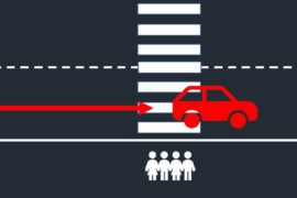
Dangerous driving behaviour at pedestrian crossing

Near miss detection at pedestrian crossings

Kradient Intelligence

Finished Q2/2021 Detection of near miss events at pedestrian crossings by using machine vision.

Goal: Testing the detection of dangerous driving behaviour at pedestrian crossings

Contact: Janne Rinne (Forum Virium Helsinki)

This project is one of the selected agile pilots. The solution was tested in the spring of 2021 as the first phase of the agile pilot process.

Lidar

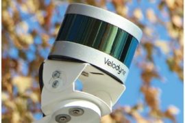
Traffic monitoring with LIDAR and edge computing

Nodeon

Testing the use of LIDAR technology and edge computing in traffic monitoring for the purposes of traffic management, planning and counting.

Goal: Testing the feasibility of LIDAR technology for traffic monitoring

Contact: Janne Rinne (Forum Virium Helsinki)

This project is one of the selected agile pilots. The solution was tested in the spring of 2021 as the first phase of the agile pilot process. In the fall of 2021, a second phase of the pilot was done, extending the pilot to also include the testing of C-ITS messages based on the detections.

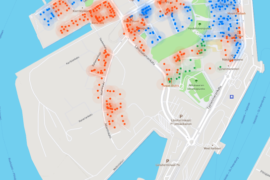
Map of Jätkäsaari with information points for last 50 meter routing

Last-meter routing for delivery logistics

Tietorahti Oy

Finished Q1/2021 The Tietorahti mobile map provides detailed location and information about the entrances of buildings in the city center of Helsinki. The map also includes official loading sites for logistics as well as no-parking zones that are used for logistics. Once parked, the driver can switch from the mobile map to the routing tool Gatesolve which gives the shortest route to the right entrance by foot.

Making urban delivery logistics smoother by detailed entrance data and last-meter routing tool.

Schedule Q4/2020 - Q1/2021

Janne Rinne (Forum Virium Helsinki)

More info about the pilot (In Finnish)

https://forumvirium.fi/tietorahti-pilotti-helsinki/

Professional drivers from logistics companies take part in the agile pilot by giving feedback about the feasibility and further development needs of the solution. They also validate and complement the data on loading sites. This pilot was one of the agile pilots done in 2020/2021.

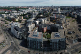
Wide aerial view of Jätkäsaari

Kiss-n-ride traffic to Jätkäsaari

Nodeon Photo: Ramboll

Nodeon's battery-powered automatic number plate recognition camera system combined with Traficom's vehicle registry determines anonymized information about vehicle traffic to and from Jätkäsaari, including their emission classes.

Goal The goal of the experiment is to gain a better understanding of the traffic to and from Jätkäsaari, including emissions related to those vehicles.

Schedule Q4/2020 and Q2/2021

Contact Janne Rinne, Forum Virium Helsinki

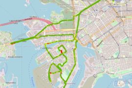
Traffic measuring points for the main junctions for vehicle traffic to and from Jätkäsaari. The objective is to get a better understanding of the traffic to and from Jätkäsaari. In addition to just number of vehicles, also the time spent there (e.g. short visits for maybe dropping off people to the terminal) as well as estimates of the emissions they bring in. There will be two measuring periods, first one being in Nov/Dec 2020 and the other in the spring of 2021.

The camera-based devices automatically identify licence plates of cars, and derive technical vehicle information from Traficom’s database. The use of licence plate information is approved by Traficom and it complies with national privacy and data security requirements.

No personal information (such as car owners’ names, addresses etc) is queried in the process. Vehicle information is used to produce traffic statistics, and individual road users cannot be identified at any stage of the analysis.More information on Nodeon’s solution, including data privacy can be found here.
User on an e-scooter

Micro-mobility data analysis

Vianova

Finished Q4/2020 Aggregated and anonymized mobility data from the micro-mobility operators will be available for the city in a dashboard, providing an overview of how, when and where the e-scooters, city bikes and other light vehicles are used and parked.

Goals The goal is to better understand the possibilities and tools for monitoring the use of e-scooters and other micro-mobility vehicles.

Timetable 4/2020-12/2020

Contacts Janne Rinne, Forum Virium Helsinki

Vianova’s solution is based on MDS (Mobility Data Specification) communication protocol which enables bilateral and secure exchange of data between mobility providers and cities.