Projects

There are several smart mobility projects and pilots ongoing and completed in Helsinki - primarily focused in the West Harbour area and Jätkäsaari. The different cases include smaller experiments as well as bigger projects with different research aspects (e.g. EU projects).

Mapping Accessible Pathways

Company: Dreamwaves

Testing a solution based on using augmented reality to identify and map accessibility related issues in the urban environment.

Finding new ways to produce accurate accessibility data

09-12/2024

Juho Kostiainen, Business Helsinki & Satu Reijonen, Forum Virium Helsinki

The pilot with Dreamwaves addresses the lack of detailed accessibility information. The pilot was selected through the EIT Urban Mobility’s RAPTOR program for the challenge posed by Mobility Lab Helsinki (read more about the challenge here).

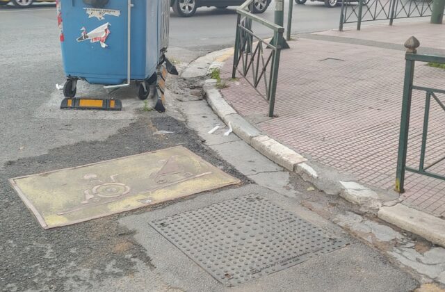
The solution is based on a mobile application that uses augmented reality and allows users to collect and annotate obstacles and issues on the streets, such as blocking objects like construction sites, e-scooters, potholes etc.

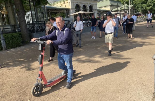
E-scooter with Drover's PathPilot

E-scooter safety tech

Companies Drover AI, Voi Technology, Vianova, VTT

Testing an AI and computer vision solution for analyzing e-scooter rider behaviour and identifying infrastructure elements.

Goal Analysing e-scooter rider behaviour

Schedule Summer-Fall 2023

Contact Juho Kostiainen, Business Helsinki

The three-month case study pilot was carried out in collaboration between Drover AI, Voi Technology, Vianova, VTT and Mobility Lab Helsinki. Drover’s PathPilot solution was installed on 25 of Voi’s e-scooters. In the first phase, it collected data about the infrastructure the e-scooters ride on. The second phase of the pilot introduced audio signals related to rider behaviour (such as alerts when riding on pedestrian streets, parking).

The case study produced a white paper analyzing the observed rider behaviour. The results were promising. For example, riding e-scooters on sidewalks was reduced during the test period. Continuation of testing with an expanded time and scope might be considered. Read more about the results.

“From the images collected by the scooters, we obtained accurate information about, among other things, potholes on sidewalks, which can be a safety risk for road users. Additionally, several situations were observed where, for example, a parked car blocked access to the bicycle lane,” says Juho Kostiainen, Project Manager of Mobility Lab Helsinki.
URBANE project logo

URBANE

Companies: LMAD, DB Schenker, Soben/TwinswHeel

The Horizon project URBANE is looking for solutions for improving city logistics. In Helsinki, piloting in 2023-2024 will be focused especially on autonomous delivery solutions.

Goal: Developing and piloting alternative (autonomous) last mile delivery solutions

Schedule: 9/2022-2/2026 (pilots in 2023-2024)

Budget: Total budget 10 M€ (1,2 M€ for the partners involved in Helsinki pilot)

Suvi Vähä-Sipilä (Forum Virium Helsinki)

The URBANE project is aimed at developing a replication and scale-up model for successfully replicating smart green last-mile delivery solutions. It will use a PI-inspired innovation framework and digital twins with real life pilots in different cities around Europe. The activities in Helsinki are focused on developing and testing sustainable and viable last mile delivery solutions, and particularly autonomous systems. The Helsinki pilot partners include LMAD (Last Mile Autonomous Delivery, operating an autonomous system), DB Schenker (as the logistics operator) and Soben/TwinswHeel (as a provider of the autonomous platform) with Forum Virium Helsinki managing the pilot with the support of Helsinki/Mobility Lab.

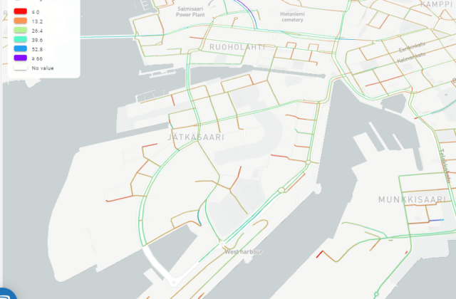
Traffic speed visualization for West Harbour

Visual traffic analytics

Companies: xyzt.ai & GeoMobility

The pilot studies the possibilities and quality of different traffic data sources (particularly floating vehicle type data) for different traffic analysis purposes.

Goal: Understanding the possibilities of different data sets for traffic analysis in Helsinki

Schedule: 9-12/2022

Contact: Juho Kostiainen (City of Helsinki) & Janne Rinne (Forum Virium Helsinki)

In the pilot, xyzt.ai’s visual analytics platform is used for studying traffic flows and quality of data sets provided by GeoMobility. The objective is to better understand the quality and coverage of different data sets in the Helsinki area, and how they serve different needs and how they can be analyzed (e.g. routes, speeds and delays of traffic). For the companies, it provides a chance to build knowledge on regional data sources, challenges and needs.

The public summary report is available here as pdf.

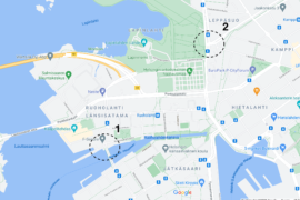
Map with indicated test locations

Ubiwhere and traffic measurements

Ubiwhere

Open data was produced by the Portuguese Ubiwhere with different technologies in two locations in the West Harbour area. The data is produced in The Crusell bridge and Mechelininkatu-Pohjoinen Rautatienkatu intersection. During the spring and fall of 2021 open data was produced in two additional locations in Selkämerenkatu and Pohjoinen Rautatiekatu. In addition to traffic data, the Crusell bridge and Mechelininkatu sites also included air quality stations.

Testing traffic data measurements and producing open data from relevant intersections in the area.

1/2021-12/2021

Matias Oikari (Forum Virium Helsinki)

The API documentation for the open data can be found here: https://urbsense.urbanplatform.city/api/public/docs/.

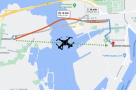
Drone path

Drone delivery service

Third Space Auto, Fly-By Guys

Finished Q4/2021 Drone-based delivery services to the district of Jätkäsaari. The pilot test both the feasibility and usefulness as well as citizens' views about using drones as a means for delivering items.

Goal: Testing the usefulness of drone deliveries

Contact: Matias Oikari (Forum Virium Helsinki)

This pilot is one of the selected agile pilots from the call in the summer of 2020.

InnoTrafik's sensor capsule

Smart pedestrian warning system for the visually impaired

InnoTrafik

Finished Q2/2021 A smart warning system for the visually impaired at pedestrian crossings.

Goal: Testing the feasibility of a warning system for the visually impaired

Contact: Janne Rinne (Forum Virium Helsinki)

This project is one of the selected agile pilots. The solution will be tested in the spring of 2021 as the first phase of the agile pilot process.

Trombia's autonomous street sweeper

Autonomous street sweeper

Trombia Technologies

Piloting Trombia's autonomous and energy efficient street sweeper as a street maintenance solution together with street maintenance experts from Stara and the City of Helsinki.

Goal: Testing the feasibility of an autonomous street sweeper

Contact: Janne Rinne (Forum Virium Helsinki)

This project is one of the selected agile pilots. The solution was tested in the spring of 2021 as the first phase of the agile pilot process, the second phase of the pilot is planned for spring of 2022.

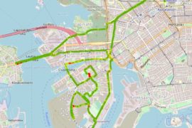
Screenshot of TerrainSense platform with data from Jätkäsaari

Bike path condition measurement

TerrainSense

Finished Q2/2021 Measuring the condition of bike paths with sensors installed in bicycles to monitor issues and maintenance levels.

Goal: Testing the use of bike-mounted sensors for bike path condition measurement

Contact: Janne Rinne (Forum Virium Helsinki)

This project is one of the selected agile pilots. The solution was tested in the spring of 2021 as the first phase of the agile pilot process.

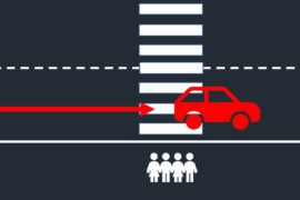
Dangerous driving behaviour at pedestrian crossing

Near miss detection at pedestrian crossings

Kradient Intelligence

Finished Q2/2021 Detection of near miss events at pedestrian crossings by using machine vision.

Goal: Testing the detection of dangerous driving behaviour at pedestrian crossings

Contact: Janne Rinne (Forum Virium Helsinki)

This project is one of the selected agile pilots. The solution was tested in the spring of 2021 as the first phase of the agile pilot process.